|
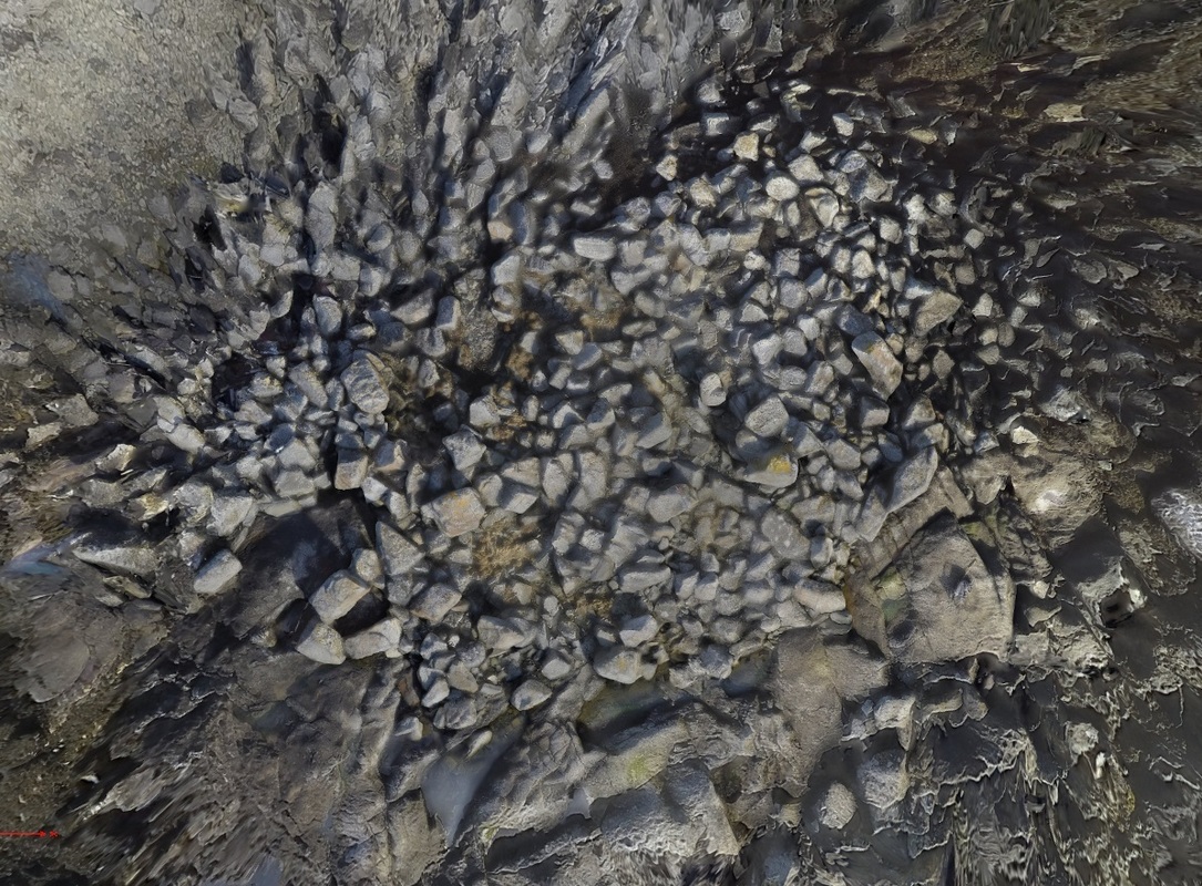
The "Dun" site here is a SCHARP red-listed site. We think it has been misidentified in the past and the actual site is the rocky outcrop twenty metres south of the grassy islet that has been identified as the site by others. The image to the left is a plan view of the site created using Agisoft Photoscan. Rough alignments of stone can be seen although coastal erosion has significantly affected the site.
In the soil at this site, we did find the pottery sherd and the tooth photographed here. |
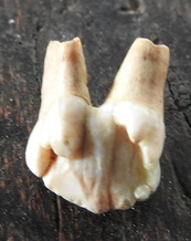
Tooth - dog or pig?
|
Looking S
|
We also thought there was some evidence of a stone causeway being built out to the outcrop from the main grass covered island.
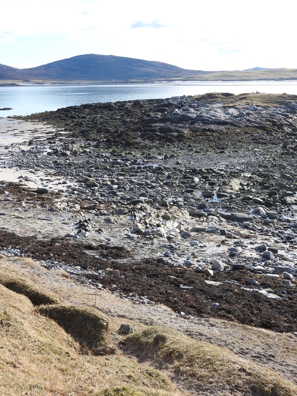
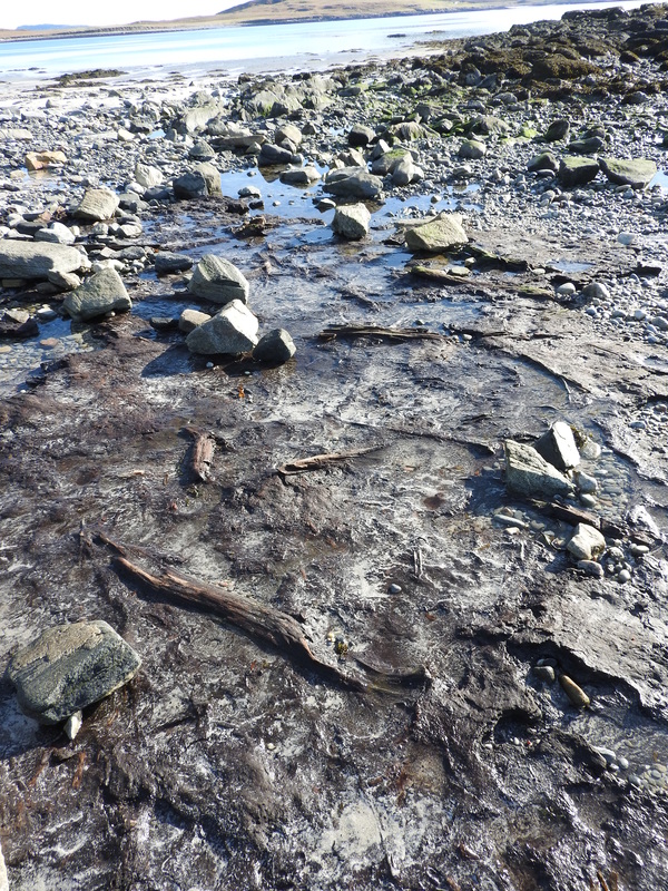
The grass covered island has no obvious structure on it, although it does hide a geocache! image to the left gives a general impression of the grass covered island relative to the shore. Between this grass covered island and the shore was an exposure of peat similar to those we have found at Baleshare. However an area of this exposure contained a lot of wood. The image at the top of the page shows a possible axe mark on one of those trunks. The wood is well preserved and one section of bark was that of Silver Birch as can be seen on the image to the right. |
Sherd 44mm by 23 mm by 6mm thick
|
Looking S
|
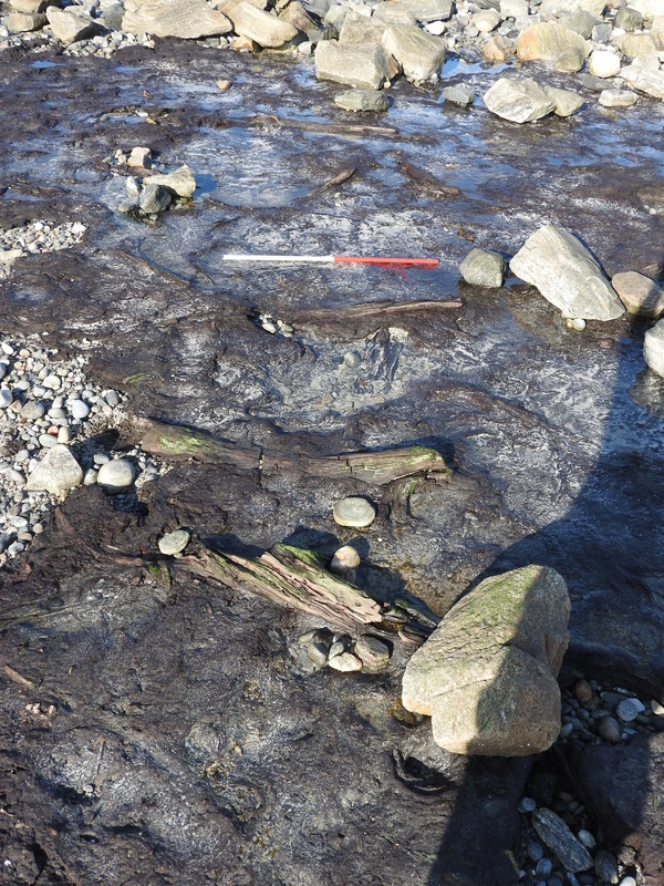
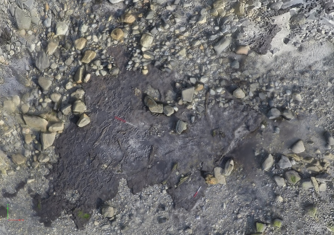
The most intriguing thing however was what appears to be an alignment of larger branches or trunks to form a timbered track leading from the rocky outcrop on the shore to the grass covered island. The branches are parallel to each other and are set down perpendicular to the obvious line from the shore to the island. There are also at least two sections of wood underneath the top branches that run along the line from shore to island.
Most of the wood is restricted to a small part of the peat exposure, perhaps further evidence that it is not a natural feature. These images, and more, can be viewed on our Flickr photostream. |
Looking N
|
This link takes you to a 3D model of the area - instructions to help open the file are here.
One possible - and to us convincing - explanation of the whole site is that the rocky islet site was in fact a Bronze Age cairn connected to the grassy island by a stone causeway and crossing the muddy lake area between today's shore and the grass covered island via a timbered track. By the Iron Age most of the wood had disappeared from the island and the sea levels would have risen so rather than a muddy lake area, this would have been the sea shore.
One possible - and to us convincing - explanation of the whole site is that the rocky islet site was in fact a Bronze Age cairn connected to the grassy island by a stone causeway and crossing the muddy lake area between today's shore and the grass covered island via a timbered track. By the Iron Age most of the wood had disappeared from the island and the sea levels would have risen so rather than a muddy lake area, this would have been the sea shore.
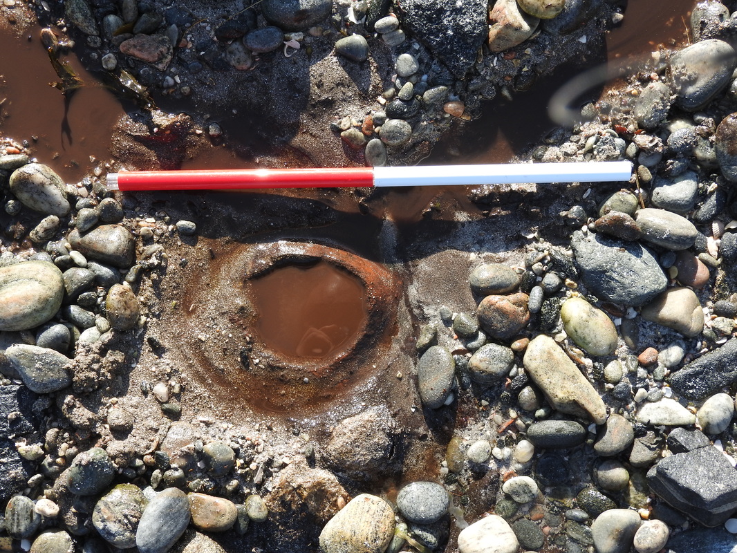
A plan view of the possible timber track. The surveying poles are 1m and 0.5m long.
|
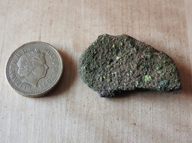
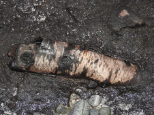
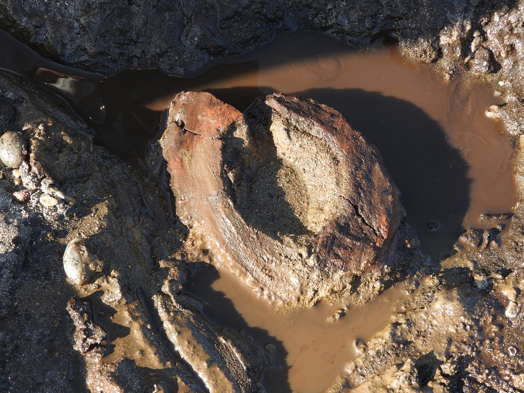
One footnote is that embedded in the shore end of the peat exposure was a circular object. We were worried about its continued existence and so have lifted it as best we could. It is difficult to determine the nature of the material of which it is made. As it dries however it increasingly looking like pottery..... |
|
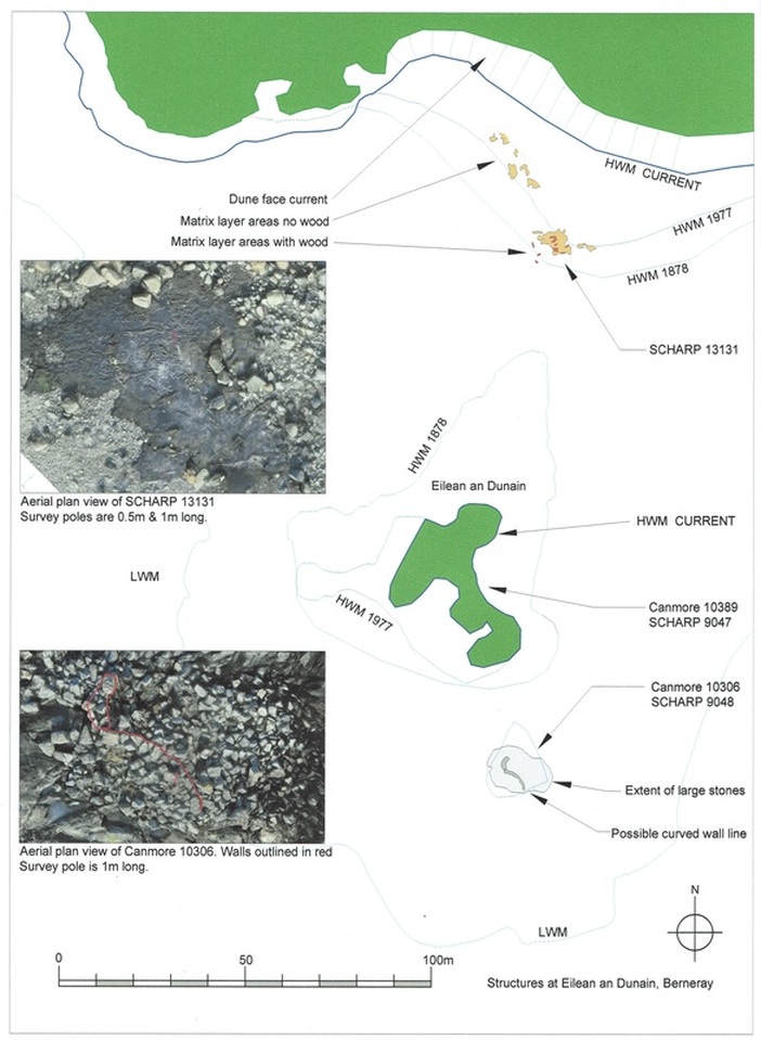
Plan of whole area
