Sidhean Tuàth, Balranald NF 71930 70176
This site is recorded on Canmore as site number 10126. It was surveyed as part of the RCAHMS Landscape Survey of 2012. As well as producing a plan, the surveyors wrote:
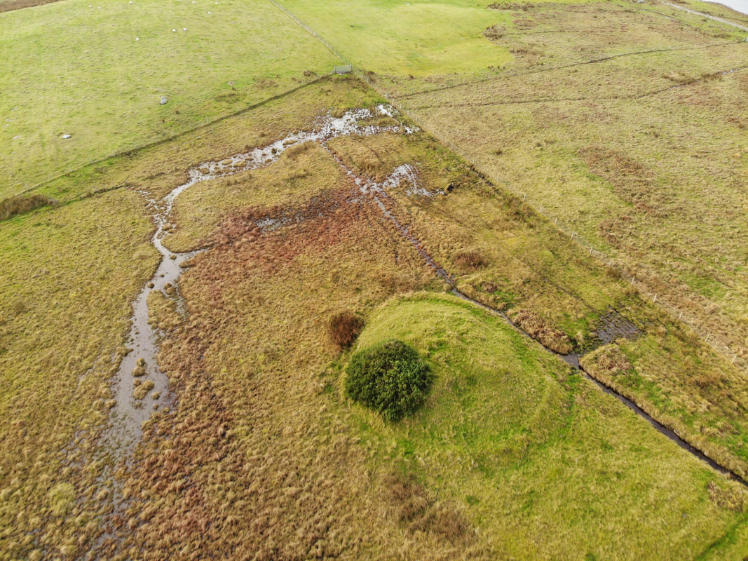
Sithean Tuath or ‘north fairy-knoll’ is a conspicuous mound situated in the drained but still marshy fields between Loch Brinishader and Loch Scaraidh. Oval on plan, it measures 15.4m from ENE to WSW by 14m transversely and rises steeply 2.8m to a flat top about 8m in diameter. A large scoop, probably a quarry or robber-trench, has removed the E part of the summit; much of the remainder of the mound is riddled with rabbit burrows.
The mound is encircled by a slight ditch and bank, the overall character of which suggests they are later in date than the mound. The ditch measures up to 1m in breadth and 0.3m in depth. A counterscarp bank is visible at the W, measuring only 0.5m across and about 0.2m in height. This ditch has in turn been cut by a large drainage channel that passes close to the mound on its NNW side. The ground outside the encircling ditch appears to be slightly lower than that within the ditch, at the foot of the mound, a situation that may indicate stripping of the outer area for fuel.
There is now nothing about this site to suggest that it is either a dun or a burnt mound. Having said that, recent communication with Mr Noel Fojut confirmed that, in 1994, when the site was visited with Miss Mary Harman, they noted that it appeared to be constructed entirely of burnt fragments of stone.
This is a shot from the E looking west.
The place name is of interest. As the Canmore reference cites ScG tuath usually means 'north' but there is no Sidhean Deas and these names usually exist in pairs. An alternative meaning of ScG tuath = ‘people’ or 'folk' and so this could the ‘the people’s fairy mound’.
ScG sithean often refers to sites with historic - and generally prehistoric - origins.
The water levels in the area are difficult to trace back in time. At one stage Loch Phaibeil, one kilometre to the S, drained through a river adjacent to the Kilmuir graveyard at Goular. This probably provided better drainage for Loch nam Fèithean and Loch Sgaraigh to the N. This would help the drainage around the mound. The 1st edition OS mapping shows lower levels in these lochs along with Loch Brinishader.
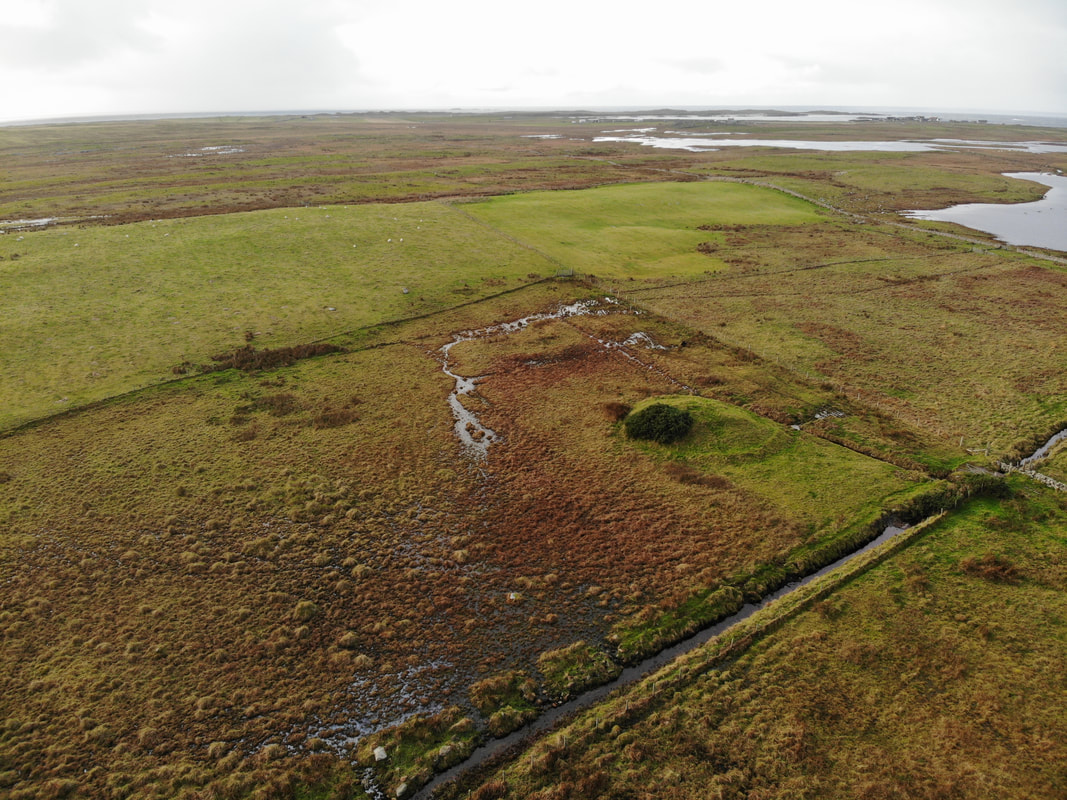
This image gives the landscape context. The drone is almost above Seanaval (Canmore 318499), the ruins of an extensive set of buildings about which there is a local tradition which states that this steading was the site of the 18th century Balranald House, seat of the Macdonalds of Balranald.
On the shore in the distance Hougharry can be seen with the Kilmuir graveyard mound to the left of it. This was an important christian site with early roots. The area to the left of that is Penmore, probably deriving from ScG peighinn Moire = 'pennyland of the Virgin Mary'. A landscape full of power and religion.
On the shore in the distance Hougharry can be seen with the Kilmuir graveyard mound to the left of it. This was an important christian site with early roots. The area to the left of that is Penmore, probably deriving from ScG peighinn Moire = 'pennyland of the Virgin Mary'. A landscape full of power and religion.