The Evolution of mapping of the Uists
The National Library of Scotland has a fantastic on-line collection of maps and these map extracts are produced with their permission for which we are very grateful.
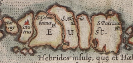
The first real map is that of Abraham Ortelius in 1573, an extract of which is above. This style of mappingthe Uist as five islands was carried on by other cartographers such as Mercator.
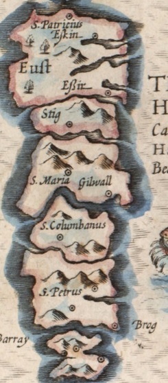
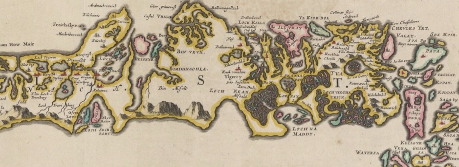
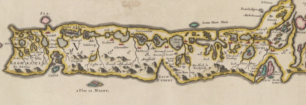
More detail was added but the five island model was refined by map-makers - John Speed's map of 1610 to the right is an example of this. Modern viewers would be much happier with north being up perhaps! The Blaeu Atlas of 1654 was however a big change with much more detail possible as the Uists were allowed one whole page to themselves. One retrograde step is that the islands went back to being one island and North was no longer up! The extracts below are below with North Uist and Benbecula first and then South Uist |
|
|
Things then continued to change between the two models. For example the Nicolas Sanson 1666 map used the Blaeu style, albeit with less detail, but Richard Blome in 1673 went back to the five island model of style of previous years.
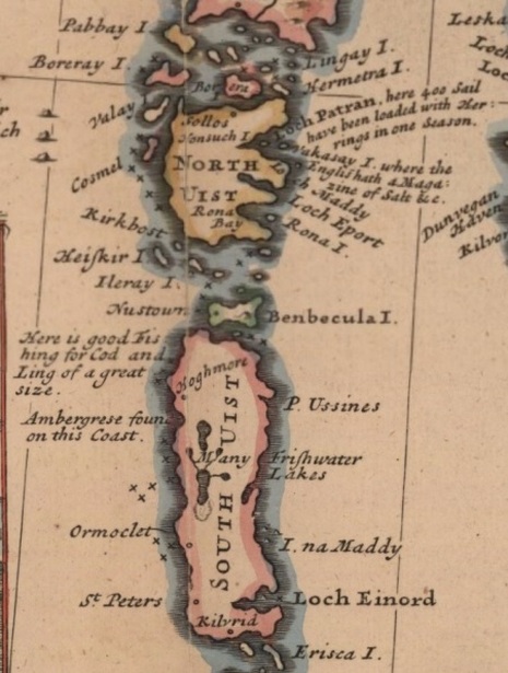
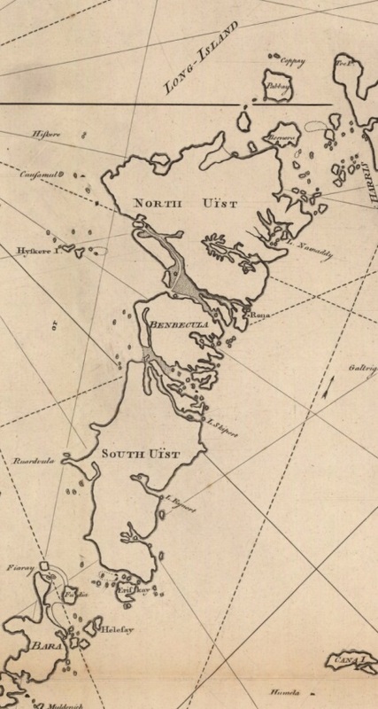
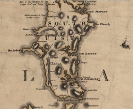
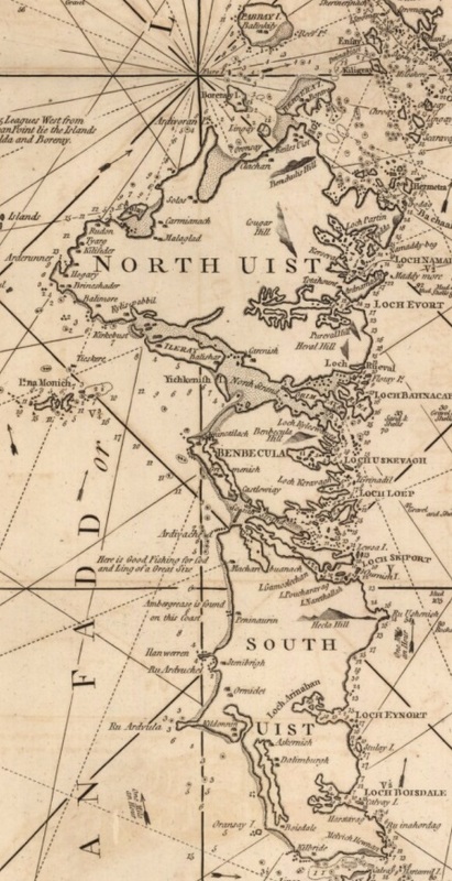
However Herman Moll made significant progress towards the maps we are used to today - the map to the left is an extract from his 1714 map. He also added some interesting comments, for example "Loch Patran, here 400 Sail have been loaded with Herrings in one season." By now, maps to aid navigation played an increasingly important part in the development of maps. In 1775 Murdoch Mackenzie produced his General Chart of the Western Isles and the West coast which is the first real map that we would instantly recognize as the Western Isles. In 1783 John Ainslie had produced a map similar to the Moll one , indeed with less detail but in 1789 had clearly had access to more material and produced his map. There are two extracts of his work are below. Comparing the two maps, it is pretty clear where that extra material came from! |
|
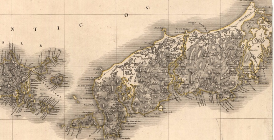
To close the 18th century Joseph Huddart produced his "New chart of the West coast of Scotland", an extract of which is below.
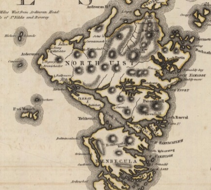
Several estate plans were made in this period, many of which survive although are not so publicly available. One that we have used a lot is the Robert Reid Estate Plan of North Uist created in 1799. William Bald created Easte Plans for both South Uist and Benbecula in 1805 which created detialed mapping for the first time at what was a fascinating time of change with the start of crofting. |
|
John Thompson got hold of the various plans and produced his atlas of Scotland. The section covering South Uist is above. And then the Ordnance Survey arrived and did their first survey in the 1870s and after that, the rest they say is history.... This pdf file attempts to identify the various locations and features on the pre-Blaeu maps. The file below contains details on several of those maps, including links to the NLS site as well as extracts of those maps for the Uists along with a Gazetteer for the maps. It is very much a work in progress....
I have put together documents trying to identify each of the places on the early maps for the whole of the Hebrides. They can be found here.
|
| ||
